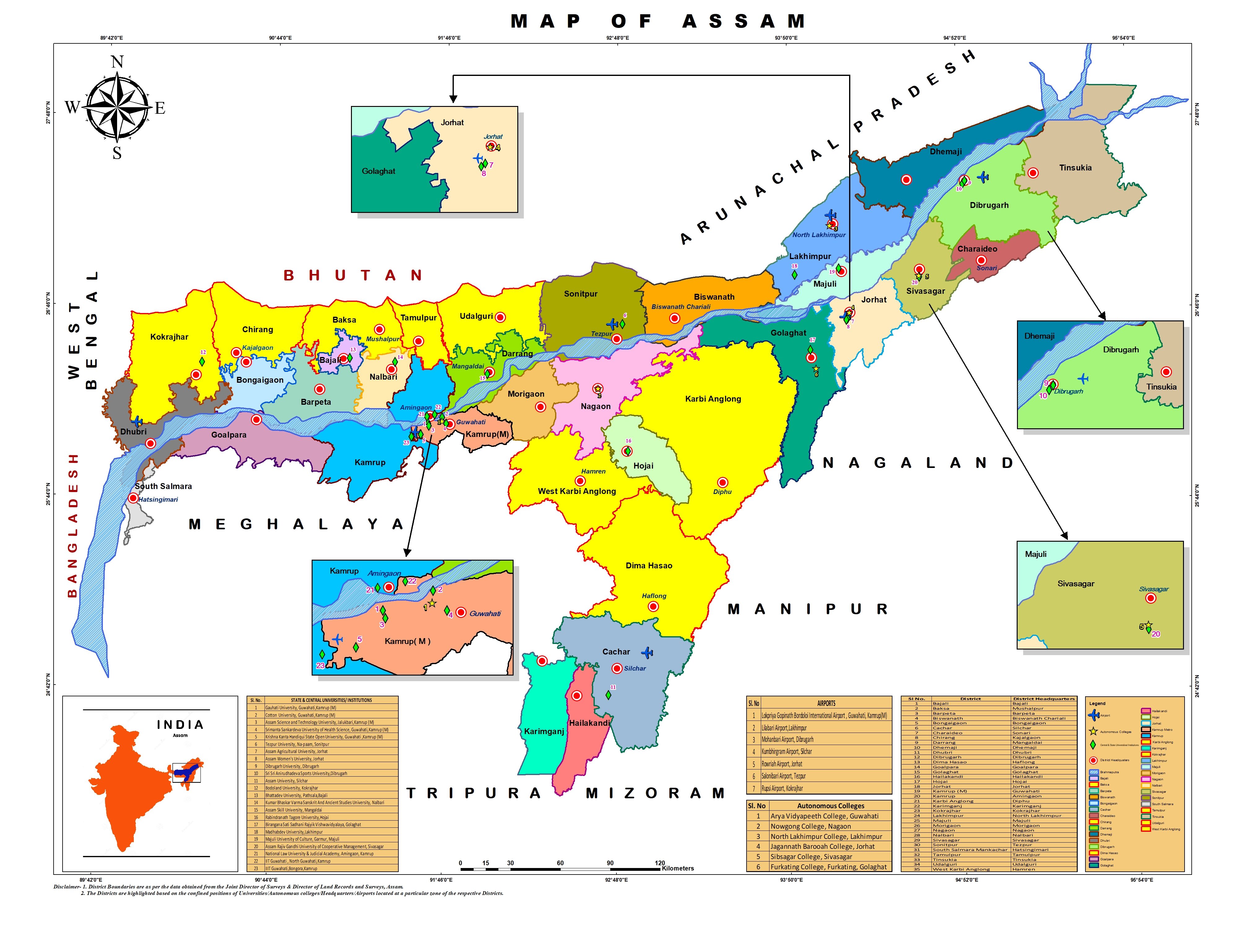
অসমৰ সবিশেষ
Breadcrumb
State Profile

| বিষয়বস্তু | বৰ্ণনা |
|---|---|
| অঞ্চল | ৭৮,৪৩৮বৰ্গ কিঃমিঃ |
| জনসংখ্যা | ৩,১১,৬৯,২৭২ |
| ৰাজধানী | দিছপুৰ |
| মুখ্য ভাষা | অসমীয়া |
| মুঠ জিডিপি |
অসমৰ অৱলোকন:
অসম ভাৰতৰ উত্তৰ পূৰ্বাঞ্চলত অৱস্হিত আৰু জনসংখ্যা অনুসৰি উত্তৰ পূৰ্বাঞ্চলৰ ৰাজ্য সমূহৰ ভিতৰত সকলোতকৈ ডাঙৰ ৰাজ্য য’ত মাটি-কালি অনুসৰি দ্বিতীয় স্হানত পৰিগনিত এখন ৰাজ্য। অসমখনে ৭৮,৪৩৮ বৰ্গ কি:মি: (৩০,২৮৫ বৰ্গ মাইল) অঞ্চল আৱৰি আছে। এই ৰাজ্যৰ উত্তৰ দিশে সিমান্তত ভূটান আৰু অৰুনাচল প্ৰদেশ ৰাজ্য; পূৱ দিশে নাগালেণ্ড আৰু মনিপুৰ; দক্ষিণ দিশত মেঘালয়, ত্ৰিপুৰা, মিজোৰাম আৰু বাংলাদেশ; আৰু পশ্চিম দিশত পশ্চিমবংগ অৱস্হিত। অসমৰ এটা গুৰুত্বপূৰ্ণ ভৌগোলিক দিশ হ’ল যে ই ভাৰতৰ প্ৰাকৃতিক ভুগোল সম্বন্ধীয় ছয়তা বিভাজনৰ ভিতৰত তিনিটাৰে সম্বলিত-উত্তৰীয় হিমালয় (প্ৰাচ্য পাহাৰ), উত্তৰীয় ভৈয়াম অঞ্চল (ব্ৰহ্মপুত্ৰ ভৈয়াম) আৰু ডেক্কান মালভূমি (কাৰ্বি আংলং)।
উচ্চ স্তৰীয় আৰ্দ্ৰতা আৰু ধাৰাসাৰ বৰষুণৰ সৈতে অসমৰ জলবায়ু সাধাৰণতে ‘ক্ৰান্তীয় মৌচুমী বৰ্ষাৰণ্য জলবায়ু’। ইয়াত বাস কৰা লোকসকলে গৰম গ্ৰীষ্মকাল আৰু মৃদু শীতকালৰ সৈতে গোটেই বছৰ জুৰি এক মধ্যমীয়া জলবায়ু উপভোগ কৰে। বসন্ত (মাৰ্চ-এপ্ৰিল) আৰু শৰৎ (চেপ্তেম্বৰ-অক্টোবৰ) মধ্য বৰষুণ আৰু তাপমাত্রাৰে ভৰা দুটি মনোৰম কাল।
২০১১ৰ লোকপিয়ল অনুসৰি অসমৰ জনসংখ্যা ৩.১২ কোটি। সেয়েহে ২০১১ চনত ভাৰতে অসমৰ জনসংখ্যাৰ ২.৮ শতাংশ অধিকাৰ কৰি লৈছে। অসমৰ সৰ্বমুঠ জনসংখ্যা ৩১,২০৫,৫৭৬ যাৰ ভিতৰত ১৫,৯৩৯৪৪৩ গৰাকী পুৰুষ আৰু ১৫,২৬৬,১৩৩ গৰাকী মহিলা আছে।
Geography:
A significant geographical aspect of Assam is that it contains three of six physiographic divisions of India – The Northern Himalayas (Eastern Hills), The Northern Plains (Brahmaputra plain) and Deccan Plateau (Karbi Anglong). As the Brahmaputra flows in Assam the climate here is cold and there is rainfall most of the month. Geomorphic studies conclude that the Brahmaputra, the life-line of Assam, is an antecedent river older than the Himalayas. The river with steep gorges and rapids in Arunachal Pradesh entering Assam, becomes a braided river (at times 10 mi/16 km wide) and with tributaries, creates a flood plain (Brahmaputra Valley: 50–60 mi/80–100 km wide, 600 mi/1000 km long).[53] The hills of Karbi Anglong, North Cachar and those in and close to Guwahati (also Khasi-Garo Hills) now eroded and dissected are originally parts of the South Indian Plateau system.[53] In the south, the Barak originating in the Barail Range (Assam-Nagaland border) flows through the Cachar district with a 25–30 miles (40–50 km) wide valley and enters Bangladesh with the name Surma River.
Climate:
With the tropical monsoon climate, Assam is temperate (summer max. at 95–100 °F or 35–38 °C and winter min. at 43–46 °F or 6–8 °C) and experiences heavy rainfall and high humidity.[53][56] The climate is characterised by heavy monsoon downpours reducing summer temperatures and affecting foggy nights and mornings in winters, frequent during the afternoons. Spring (March–April) and autumn (September–October) are usually pleasant with moderate rainfall and temperature. Assam's agriculture usually depends on the south-west monsoon rains.
Population:
The total population of Assam was 26.66 million with 4.91 million households in 2001.[73] Higher population concentration was recorded in the districts of Kamrup, Nagaon, Sonitpur, Barpeta, Dhubri, Darrang, and Cachar. Assam's population was estimated at 28.67 million in 2006 and at 30.57 million in 2011 and is expected to reach 34.18 million by 2021 and 35.60 million by 2026.[74] As per the 2011 census, the total population of Assam was 31,169,272. The total population of the state has increased from 26,638,407 to 31,169,272 in the last ten years with a growth rate of 16.93%.